Author’s note: This article was first published on my GMANews.TV blog in October 2009. I felt that it remained relevant and so decided to revise and re-submit it to Nordis Weekly. Now that residents of Luzon have just gone through destructive typhoon Pedring, it seems appropriate to report it again, this time in my own Iraia blog.

It is typhoon season once more, and those of us in media who have to file reports on a daily or hourly basis know how it is to be on typhoon-tracking mode—to be familiar with PAGASA terminology, to have some sense of geography, and to be on our toes for those instant weather bulletins.
This triggers in me a memorable if somewhat tragic time in October 2009, when my colleagues and I at GMA News Online were trying to keep up with reportage on two successive typhoons, Pepeng and Ramil.
If you have ever worked for a broadsheet daily, or broadcast outfit, or online news site, you will know how it is to be sweetly sucked into the delicious vortex of storm-tracking terminology and geography.
Who among us have not, at one time or another, gladly wrestled with the difference between “maximum sustained winds” and “gustiness”? Or gamely expounded on the distinction between a regular-guy “tropical storm” and a steroid-packed “super typhoon” bully?
And have we ever wondered why the preferred point of reference in measuring the storm’s striking distance is some exotic location like Aparri or Basco (as in “150 km east-northeast of Aparri, Cagayan”) instead of the more understandable “a hundred meters dead straight ahead, staring at my precious beach house”?
Sooner or later, we get to learn how to wield these terms and measures with confidence, so we can quickly turn into the newest resurrection of former chief weatherman Nathaniel “Mang Tany” Cruz (who, by the way, is now “weathering” for the Australians). We all want to sound like weather experts. That’s understandable.
But what really gets my goat is this question of landfalls. I don’t quite understand this media obsession with landfalls. It is too simplistic.
As any long-time resident of Northern Luzon will tell you, it isn’t necessarily the exact route of the center of the storm on the map that defines its path of destruction, but the strength and breadth of its reach – the wallop of its winds from center to rim, its total payload of torrential rains, and how long it stays in the vicinity.
Tracking a typhoon and asking where The Fearsome Landfall would strike is like looking at a 200-kiloton cruise missile about to hit a house, and worrying if the entry point would be through the door or through the window.
Take for example the famous Pepeng visit in October 2009. When the super-typhoon was still at sea, heading straight for Northern Luzon’s solar plexus, there was a moment of speculation whether “the landfall” would be in Isabela or Cagayan, and whether it would attack at noon, mid-afternoon, or at dusk.
As it turned out, it didn’t matter. We all know what happened after that. Pepeng, who apparently did not agree with the concept of a plain and simple landfall, confounded us with complex multiple ones instead.
Most of us counted three landfalls. But for me, the number and exact location of Pepeng’s landfalls were immaterial. I froze in terror instead, as Pepeng the sky dragon did a couple of gigantic figure-of-eight pirouettes across the prone helpless body of our northern regions, its claws ripping up the land with floods and landslides.
After Pepeng came another weird typhoon, equally erratic but with a different personality. Unlike killer dragon Pepeng, Ramil was a tricky clown that danced around us, poking its umbrella here and there, always threatening to do a landfall but never quite making it to solid ground.
After days of tracking Ramil’s snake-like movements off the east coast then north coast of Luzon, and perhaps just a bit tired of endless media questions about the Expected Landfall’s when and where, Mang Tany the practical weatherman had to say it bluntly: “Whether it makes a landfall or not is no longer material. Ramil is here.”
But since we media people remain obsessed with landfalls anyway – can’t get enough of it, I suspect – let me tell you something:
No reporter, I dare say, absolutely no one, will ever really grasp the immensity of a landfall unless they are actually there, on the ground, staring at the eye of the storm as it arrives during H-Hour.
I don’t mean staring at the color-enhanced satellite image of the storm, its eye a deep digital red, as it creeps nearer and nearer the familiar shape of the Philippine coastline, rendered as a fragile outline in PAGASA maps.
I don’t mean watching a video at the fringes of the storm as it makes itself felt, whiplashing trees and coconut fronds and iron roofs and electric posts.
No, I mean staring at the eye of the storm, literally, while standing on the ground and looking up. I mean staring at the eye of the storm as it passes overhead and stares back at you.
Let me now satisfy your curiosity: What does a landfall feel like, really?
In 1964, I was a young grade-school kid growing up in Quezon City when Typhoon Dading (international codename: Winnie) hit the country. Wikipedia says that “the 1964 Pacific typhoon season was the most active season in recorded history with 39 storms,” and Dading was just the fourth of the season.
With 185 kph winds, Dading would have been classified today as a super-typhoon. It was one hell of a typhoon, as I recall, especially because it made a dead-on landfall in the Manila area. It did not lose much strength near the center, because the small landmass around Luzon’s narrow waist, from Infanta to Manila, did not offer much resistance.
As the fringes of the storm hit the metropolis, the gale-force winds literally screeched and screamed, accompanied by torrential rains that lashed almost horizontally against everything in its path. The bedlam worsened increasingly as the day wore on, ripping roofs and billboards, toppling posts and uprooting trees as the center of the storm approached.
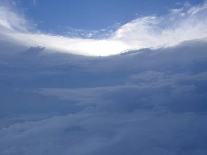
Then as the eye of the storm reached Metro Manila – an abrupt calm settled on the land. The wind died with a whimper, literally. The sky cleared, and the bright noonday sun shone above through a roughly circular opening surrounded by thick banks of storm clouds. Then, after I don’t remember how many minutes, as the eye of the storm headed farther west, the typhoon’s fury resumed just as abruptly, but in the reverse direction.
The peaceful eye of the storm: a calm and sunny circle just a few kilometers across, surrounded by a frightful wailing wind of chaos – that is my childhood recollection of a real landfall.
So next time we in media ask a beleaguered PAGASA spokesperson about landfalls, keep this image in our minds. #

